Was Tartaria really on the maps?
How a place name on old maps becomes an erased empire.
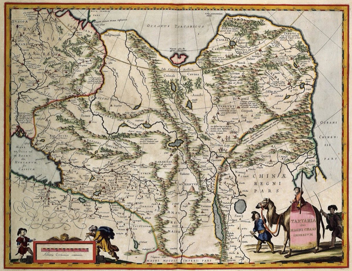
Tartaria really does appear on European maps of the 17th and 18th centuries.Anyone can check that in a library.But the word was not the name of a country.It was how Europeans lumped together the parts of Central Asia and Siberia they knew little about.
There are plenty of parallels.On maps of the same period the interior of Africa is blank or filled with guesswork.A name on a map does not mean such a state existed.It means Europeans called it that.
Tartaria material turns this around.The name disappearing from maps is read as evidence that an empire was erased.Half-buried basement floors of 19th-century buildings become traces of a mud flood.The great halls of the world's fairs become that empire's buildings, briefly put back on show.
Those sunken floors have known causes.As cities grew, street levels were often raised.Many buildings were built half below grade from the start, for drainage and footing.The fair halls were temporary structures of plaster and timber, put up quickly and meant to come down.
The place name is a fact and the erased empire is a claim.The distance between the two is the whole story.
How one sunken basement floor becomes evidence of a global catastrophe.
Read further
- Tartaria: An Erased Empire and a Flood of MudHow a place name on a map becomes a vanished, ancient civilization